
Corridor Through the Mountains
Smith's Clove: Wartime Line of Communication and Passageway for the Continental Army, 1776-1783
Richard J. Koke
[Editor's Note: Richard J. Koke authored a series of five articles that appeared in Volumes 19 -23 of the OCHS Journal between 1990 and 1994. These articles will be presented in multiple sections over the next few years.]
Part V:
Finally, A Dreary Blockhouse
Chapter 6:
Blockhouse in the Clove
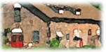
Though Washington had brought up a refortification of the lower Clove in November 1780 with a blockhouse at Sidman's bridge, nothing is known of any work undertaken until the spring of 1781. Winter snow and the unrest of the Jersey revolt were sufficient to contribute to a delay until April 12, when Hamilton wrote that the commander-in-chief "had ordered the block house in the Clove to be continued", the General Orders issued the same day directed that a fatigue party consisting of a subaltern, one sergeant and twenty-five rank and file, equipped for a tour of ten days, was to march on the following day to athe place where the Block-house is erecting in the Clove" and the officer in charge was to take orders from Major Jean Bernard Gauthier de Murnans (Murnand) of the Continental Corps of Engineers - one of a cadre of experienced French engineers who had come to America before the alliance to seek rank and employment.
In proposing its construction, Washington had suggested that it be built either where the old barracks stood near the bridge or on a height south of the Ramapo River, but its final location north of the stream is determined by an entry in the record book of Haverstraw precinct on May 24, 1782, which described the northward course of the Clove Road from Suffern's tavern to the eighteenth-century precinct line at the southerly edge of Sloatsburg. According to the record book, the highway coursed its way from the tavern to the river and across Sidman's bridge, and "thence passed [past] the Block House" towards the dividing line separating the precincts of Haverstraw and Cornwall that crossed the highway between the houses of the Widow Sidman and Stephen Slot (Slott).
A further clue to its location is found in a letter written by Captain James Duncan in November 1782, who said that the blockhouse stood about fifty yards from a "small house" and about fifty from a "little hut", one located in the direction of Mr. Suffern's and the other towards Mrs. Sidman's. The "small house" was probably the Shuart dwelling indicated by Erskine on the west side of the Clove Road close to the river and bridge, which would place the location of the blockhouse about two hundred feet from the Ramapo in proximity to the present junction of Routes 17 and 59 in the area of the "little redoubt" of 1776 and the "Old Fort" shown on Erskine's maps. As best as can be determined, it must have stood near the former Ramapo Presbyterian Church, now devoted to God's service as the Gates of Praise Church.
In 1945, George H. Budke, historian of the Rockland County Society, offered a speculative suggestion that the blockhouse may have stood on a plateau on the north slope of Little Mountain which flanks the Sidman's bridge position on the west. The precinct book entry, however, would seem to suggest a location lower down and closer to the road where the highway could be better watched and traffic controlled than from the somewhat remote nearby plateau.
Duncan likewise provided the only description of the blockhouse (for him, a hated place), describing it as a strong two-story structure about thirty-six feet square, with a single chimney stack that allowed for a large fireplace on the ground floor and two very small ones on the second. Though intended both as a defensive work and a shelter for the garrison, there seemingly were no sleeping facilities provided; Duncan reporting there were no bunks or anything of that nature in the building when he arrived at the end of 1782. In appearance, it probably was not unlike the wooden blockhouse on the Verplanck's Point shore of King's Ferry that was described by observers in 1780 and 1781 as a "square tower". References to it during the next two years was always as "the blockhouse in the Clove". An abatis surrounded the building.
Part I
Introduction
Clove and Precinct
The Clove Road
The Clove Taverns
Clove Taverns II
Part II
Prelude to War
The Continentals Arrive
Blocking the Clove
In the Midst of Tories
Offensive from the Highlands
The Militia Take Over
The Post at Ramapo
The Reluctant Militia
Holding the Line
An Embarrassing Situation
To Galloway's and Back
The Scotsman's Regiment
September Raid
Prelude for Disaster
Clinton Takes the Highlands
Sidman's Bridge: The Last Holdout
Part III
Introduction
Summer, 1778
A Cogent Appraisal
Villains and Robbers
Part IV
Introduction
Aaron Burr's Ride
March to the Clove
The Barren Clove
Bracing for Attack
Among the Rocks and Rattlesnakes
The Present Interesting Occasion
A Waiting Game
Redeployment
The Continental Road
The Taphouse Keeper's Daughter
The Indian Fighters Appear
March to Morristown
Part V
Introduction
A Fruitless Excursion
Summer at the Clove
A Frenchman's Journey
Pompton Mutiny: Blood in the Snow
Blockhouse in the Clove
The Allies at New Antrim
The Intercepted Messenger
A Questionable Story
What Really Happened
Perils of A Post Rider
New Yorkers at the Clove
Congress' Own Regiment
The Last Garrison
A Man of Passion
Homeless Canadians
The Last March
Part VI
Introduction
The Post at Sidman's Bridge
Marking the Site